Category:Maps
Jump to navigation
Jump to search

visual representation of a concept space; symbolic depiction emphasizing relationships between elements of some space, such as objects, regions, or themes _ESA23162625.png)  | |||||
| Upload media | |||||
| Pronunciation audio | |||||
|---|---|---|---|---|---|
| Instance of | |||||
| Subclass of |
| ||||
| Part of |
| ||||
| Different from | |||||
| |||||
Before changing or adding maps, please read the brief guideline on the organizational schema About this Category developed during an eight month effort by a working group in 2007–2008.
- See also maps needing categories in Category:Unidentified maps
- See also these related categories: (These categories may contain more maps. Please categorize them in map categories.)
- Category:Cartography – for map symbols, projections, etc.
- Category:Demography
- Category:Geography
- Category:Aerial photographs
- Category:Satellite pictures
- Category:Astronomical maps – maps and star charts
- Category:Cartographic reliefs for models of landscape profiles
Resources:
Subcategories
This category has the following 29 subcategories, out of 29 total.
Pages in category "Maps"
The following 5 pages are in this category, out of 5 total.
Media in category "Maps"
The following 200 files are in this category, out of 354 total.
(previous page) (next page)-
 23 0009705 Convair Negative Image.jpg 1,594 × 1,600; 1.19 MB
-
 23 0009707 Convair Negative Image.jpg 1,600 × 1,591; 1.38 MB
-
 4 colors.jpg 1,920 × 1,080; 460 KB
-
 Anshan-Stadt.jpg 2,484 × 941; 439 KB
-
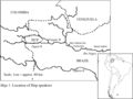
 Argentina Nicaragua Locator.png 317 × 531; 41 KB
-
 Barangay San Miguel, Lobo Map.png 1,624 × 1,343; 467 KB
-
 Brabantse wouden kaart en legende-022.jpg 3,508 × 2,480; 613 KB
-
 Brain Maps.JPG 1,915 × 1,033; 340 KB
-
 BRUMMWAY.png 486 × 623; 110 KB
-
 Bulgaria 1994 CIA map Modifiziert Route.jpg 800 × 791; 1.2 MB
-
 Catamarca Provincia.jpg 1,221 × 1,722; 364 KB
-
 ChanuForges.jpg 2,829 × 2,109; 1.29 MB
-
 Chicago Portage National Historic Site.png 2,134 × 2,159; 1.41 MB
-
 Classification and Distribution Map of the Ngái Ethnic Group in Vietnam.jpg 1,280 × 720; 94 KB
-
 Cole's Map.png 1,633 × 821; 432 KB
-
 Commonwealth of Nations Map.png 7,192 × 3,318; 1.07 MB
-
 Communauté de communes Provence Verdon.png 674 × 599; 83 KB
-
.png/95px-Countries_that_recognise_the_state_of_Palestine_(Finnish).png) Countries that recognise the state of Palestine (Finnish).png 4,767 × 6,000; 1.52 MB
Countries that recognise the state of Palestine (Finnish).png 4,767 × 6,000; 1.52 MB
-
 Courlans-Jura.jpg 1,930 × 1,929; 1.12 MB
-
 CrimeAnticipation.png 965 × 470; 689 KB
-
 Dean Trust 2024 Map.png 801 × 431; 149 KB
-
 Dendermonde en deelgemeenten.png 934 × 657; 129 KB
-
 Dhana-Governorate.png 1,080 × 1,080; 58 KB
-
 Diofwa.png 1,287 × 1,037; 327 KB
-
 Distribution of the Acheulean cultural tradition as it is currently understood.webp 1,743 × 1,048; 239 KB
-
 Divisao Administrativa de Ulongue.jpg 837 × 615; 114 KB
-
 División territorial de Nueva Concepción.png 753 × 720; 168 KB
-
 Dyuktai Cave map location.png 785 × 647; 140 KB
-
 Dz 15 Bouarfa.png 1,024 × 1,024; 135 KB
-
 Députés des français de l'étranger XVIe législature.svg 512 × 260; 912 KB
-
 ECSA-HC-Map.jpg 596 × 584; 65 KB
-
 Emplacement Caméra d'Arnaudin.jpg 1,237 × 559; 224 KB
-
 Emplacement Villas romaines Villers.jpg 1,509 × 1,404; 1.15 MB
-
 England Project Emily relief location map.jpg 754 × 792; 80 KB
-
 English Antalas Presence map.png 1,024 × 901; 214 KB
-
 Ernest.png 1,891 × 840; 302 KB
-
 Etats membres du Groupe Pompidou.jpg 6,457 × 3,269; 1.34 MB
-
 Etats membres du MedNet.jpg 4,093 × 2,095; 388 KB
-
 ETS 2 Map DLC.png 4,592 × 3,196; 1.56 MB
-
 ETS 2 Map.png 4,592 × 3,196; 1.54 MB
-
 EU air carrier restrictions map revised Feb 2022.png 2,754 × 1,398; 467 KB
-
 European Intervention Initiative map.png 1,920 × 1,468; 506 KB
-
 Evacuation-cost-map-based-on-land-use-and-slope.jpg 1,260 × 1,059; 1.66 MB
-
 Everett Smelter Contaminated Soil Cleanup Map.png 890 × 1,126; 366 KB
-
 Exilien atlasbassinversantdetroisrivieres2015 2~2.jpg 1,232 × 1,272; 316 KB
-
 Exposure-left-and-relative-risk-right-map-for-infrastructure-roads-railways-pathways.png 1,831 × 1,329; 1.12 MB
-
 ExtremePuntenVlaanderen.png 1,102 × 458; 73 KB
-
 Falk Oberdorf Karte Bergkirchen.png 620 × 596; 59 KB
-

-
 FINABEL Countries 2024.png 1,479 × 1,078; 439 KB
-
 First Sino-Japanese War - Chinese version.jpg 2,000 × 2,615; 407 KB
-
 Fort Irwin National Training Center USGS Map.jpg 1,230 × 1,304; 548 KB
-
 Fourth World map.png 220 × 141; 35 KB
-
 From Mud Lake Peak to Lassen's Meadows Reduced From Beckwith's Map - NARA - 93193311.jpg 4,720 × 3,228; 836 KB
-

-
 From U.S. Coast Survey Chart of the Gulf Coast of the United States - NARA - 122206749.jpg 6,856 × 5,897; 1.74 MB
-
 Ft-Heath-Map-1921.jpg 678 × 464; 133 KB
-
 G commonwealth g map.gif 800 × 400; 61 KB
-
 G11695.png 3,558 × 2,516; 9.2 MB
-
 Galabert projet Louis-Philippe-Ville.pdf 1,239 × 1,752; 290 KB
-
 Gaziantep Kahramanmaraş depremleri harita 2.jpg 3,933 × 2,002; 2.29 MB
-
 Geographic regions of Europe.png 6,300 × 3,499; 1.79 MB
-
 Gofa Zone Map 2.jpg 24,000 × 18,000; 15.14 MB
-
 Greats Migration african american's in USA 1910-1970.png 2,048 × 1,150; 744 KB
-
 Grenzen Naturschutzgebiet.png 832 × 999; 1.86 MB
-
 Harta fizike e rrethit Tropoje.png 656 × 506; 431 KB
-
 Hartă.jpg 225 × 225; 6 KB
-
 Hazara Division Map and Jagirdars.jpg 1,080 × 1,710; 841 KB
-
 Heavily Indebted Poor Countries As of 29 Jan 2021.svg 940 × 415; 1.49 MB
-
 Herrera y la fábrica de jabón de Josefa Tito Recalde hacia 1851.jpg 660 × 548; 226 KB
-
 Hidaka-Hokkaido 2006-2-28.png 539 × 599; 44 KB
-
 Hip test 08-31-21.svg 1,514 × 800; 462 KB
-
 Hk416 map 2024 02 08.png 6,460 × 3,403; 2.24 MB
-
 HO -2570, Moresby Passage to Gabriola Pass - NARA - 84785960.jpg 24,892 × 18,624; 60.7 MB
-
 Hotakid-Dynasty-1728.png 620 × 429; 232 KB
-
 Hurricane Laura rainfall.png 462 × 557; 159 KB
-
 I dialet del catalan.jpg 1,496 × 1,745; 871 KB
-
 I dialet del romagnoeul.jpg 916 × 775; 377 KB
-
 Idea and the attempted actualization - Reworked.svg 1,415 × 479; 59 KB
-
 Igdir Districts.png 1,857 × 941; 24 KB
-
 IHM שביל דרום הגולן.jpeg 1,600 × 1,267; 322 KB
-
 Ikastolaren Kokapena.png 271 × 191; 46 KB
-
 Iliria.jpg 1,427 × 1,410; 153 KB
-
 Imperio bizantino siglo XV.jpg 1,024 × 905; 188 KB
-
 Imperium coloniale Francicum.png 2,753 × 1,400; 151 KB
-
 Imrs.webp 691 × 342; 22 KB
-
 Indicator exilis range map.png 2,036 × 814; 158 KB
-
 Infog carte zad france.png 697 × 1,481; 489 KB
-
 Interceptores-aguas-servidas-en-santiago.png 374 × 334; 88 KB
-
 International Recognition of the State of Palestine.png 7,000 × 4,192; 4.29 MB
-
 Internationaler Straßenpreis um den Henninger Turm 1962.jpg 4,961 × 3,508; 2.09 MB
-
 Iran Kolbar.png 300 × 276; 46 KB
-
 Islam World.png 1,920 × 848; 284 KB
-
 ISSP map june 2022.png 1,112 × 527; 129 KB
-
 Italian Invasion 1940 in Pindus Epirus ru.svg 1,335 × 996; 729 KB
-
 Ivmworld.png 2,000 × 1,050; 494 KB
-
 Iğdır Central District.png 1,857 × 941; 25 KB
-
 Iğdır within Iğdır Central District.png 1,857 × 941; 25 KB
-
 Jammu kashmir union territory.png 1,799 × 2,048; 287 KB
-
 January 12, 1938's Unnamed system.png 638 × 442; 356 KB
-
 JESC.2022.jpg 684 × 536; 66 KB
-
 Just for user I never cry.jpg 176 × 180; 12 KB
-
 Kadena and Yomitan, January to December 1945.png 2,418 × 1,144; 2.62 MB
-
 KarooLamb Map.jpg 1,920 × 1,347; 285 KB
-
 Karte Handelsweg Brandau rot.jpg 964 × 1,459; 288 KB
-
 Karte Handelsweg Brandau.jpg 964 × 1,459; 282 KB
-
_map.png/120px-Kazakh_Horde_(Khanate)_map.png) Kazakh Horde (Khanate) map.png 1,658 × 1,247; 150 KB
Kazakh Horde (Khanate) map.png 1,658 × 1,247; 150 KB
-
 KempensDialectKaart.png 881 × 653; 29 KB
-
 KempensDialectKaartV2.png 800 × 593; 210 KB
-
 Khasavyurtovsky district locator map.svg 744 × 1,064; 481 KB
-
 Kinson map, highlighting Cunningham Crescent and Moorside Close.png 2,064 × 1,227; 2.1 MB
-
 Las Calles de las Mujeres.png 2,818 × 1,374; 658 KB
-
 Localización de Sosote en la Parroquia Sosote.jpg 610 × 705; 109 KB
-

-
 Location map1.gif 361 × 292; 10 KB
-
 Location of teams in the 2019–20 PSL.png 508 × 438; 68 KB
-
 Location of teams in the 2020–21 PSL.png 564 × 482; 99 KB
-
 Location of teams in the 2021–22 PSL.jpg 447 × 384; 34 KB
-
 Location of the Pacaya River.png 850 × 1,191; 116 KB
-
 Location plan.webp 649 × 790; 77 KB
-
 Locator Kacamatan Kabangka.jpg 866 × 827; 195 KB
-
 Lokeren Industrieparken Overzichtskaart.png 1,834 × 2,175; 3.94 MB
-
 Lược đồ căn cứ Trà Lũ, tại Nam Định.png 742 × 690; 108 KB
-
 M 6.3 Explosion - 22km ENE of Sungjibaegam, North Korea.png 1,429 × 1,014; 317 KB
-
 M.R.N.C map.tif 1,366 × 768; 857 KB
-
 Maesuai Map.jpg 3,060 × 4,080; 3.58 MB
-
.png/103px-Makedonya_(anlam_ayrımı).png) Makedonya (anlam ayrımı).png 286 × 332; 10 KB
Makedonya (anlam ayrımı).png 286 × 332; 10 KB
-
 Makkah Region - Al Ardiyat.svg Blaryan.png 420 × 426; 25 KB
-
 Mangladien mapa.jpg 1,024 × 494; 53 KB
-
 Maniwaki Quebec location diagram.png 329 × 290; 17 KB
-
 Manulning tarqalish kengligi.jpg 1,290 × 891; 270 KB
-
 Map Gudu Local Govt.jpg 480 × 779; 147 KB
-
 Map of Attu during Allied Invasion.png 1,424 × 1,073; 234 KB
-
 Map of AYODHYA or OUDH in year 1862.jpg 432 × 664; 85 KB
-
 Map of Bama.jpg 267 × 189; 14 KB
-
 Map of Bisan area aa 2024.0107.png.jp.png 1,200 × 1,200; 240 KB
-
 Map of camp kearns.png 653 × 532; 226 KB
-
 Map of Clifden. Medina County, Texas..jpg 6,817 × 10,423; 6.56 MB
-
_edit.svg/118px-Map_of_comune_of_Badia_Tedalda_(province_of_Arezzo%2C_region_Tuscany%2C_Italy)_edit.svg.png) Map of comune of Badia Tedalda (province of Arezzo, region Tuscany, Italy) edit.svg 3,426 × 3,487; 94 KB
Map of comune of Badia Tedalda (province of Arezzo, region Tuscany, Italy) edit.svg 3,426 × 3,487; 94 KB
-
 Map of Emilia and Romagna with provinces and bounderies 2.jpg 800 × 423; 53 KB
-
 Map of europe BK 2.png 2,400 × 1,094; 490 KB
-
 Map of Highton and it's boundaries.png 446 × 544; 145 KB
-
 Map of Hrubieszów District.png 575 × 768; 308 KB
-
 Map of Netzarim corridor, mostly Hebrew titles.png 800 × 566; 119 KB
-
 Map of Sheffield Local Election Results 2024.gif 512 × 320; 8 KB
-
 Map of Sorrento Coast.png 640 × 496; 64 KB
-
 Map of state religions 2.svg 512 × 263; 1.55 MB
-
 Map of state religions 3.svg 512 × 263; 1.55 MB
-
 Map of the Balqawi Clan.png 976 × 505; 438 KB
-
 Map of the Labrador & Irminger seas. With depth contours and current data.png 1,728 × 1,080; 514 KB
-
 Map of the Majeerteen Sultanate.png 1,162 × 1,862; 818 KB
-
 Map of the Sorrento Coast.png 640 × 496; 69 KB
-
 Map of UK Free Trade Agreements.png 7,192 × 3,318; 2.26 MB
-
 Map República Austral.png 4,752 × 6,203; 1.46 MB
-
 Map showing the type locality of Eurindicus bhugarbha.png 804 × 622; 728 KB
-
 Map-of-cancer-cluster-feb-2020.jpg 3,000 × 2,318; 1.22 MB
-
 Map-of-Gilgit-Baltistan-and-AJK.png 662 × 662; 126 KB
-
 Map-timeline-new.svg 4,821 × 1,024; 6.65 MB
-
 Map-to-Londolozi-scaled-e1608291953212-788x779.jpg 788 × 779; 68 KB
-
_and_other_trading_posts_in_Canada.png/120px-Map._Location_of_Buckingham_House_(HBC)_and_other_trading_posts_in_Canada.png) Map. Location of Buckingham House (HBC) and other trading posts in Canada.png 1,326 × 768; 1.37 MB
Map. Location of Buckingham House (HBC) and other trading posts in Canada.png 1,326 × 768; 1.37 MB
-
 Map03 large.jpg 2,339 × 1,654; 816 KB
-

-
 Mapa de artistas PortAmérica.png 630 × 474; 93 KB
-
 MAPA DE ELECCIONES REGIONALES PUNO 2022.png 804 × 1,304; 141 KB
-
 Mapa de las bandas del rey sindel y duque mihali llega a Barcelona.jpg 1,266 × 707; 134 KB
-
 Mapa de localização da Phalotris nasutus.png 909 × 364; 58 KB
-

-
 Mapa de Ubicación de Touwa.png 2,300 × 1,100; 77 KB
-
 MAPA DEL CANTÓN QUINSALOMA.jpg 5,498 × 13,717; 7.81 MB
-
 Mapa división política de Manzanares.jpg 1,786 × 1,429; 460 KB
-
 Mapa dos municípios do Algarve.png 1,264 × 624; 126 KB
-
 Mapa esquemático Serra do Espinhaço meridional.png 456 × 600; 292 KB
-
 Mapa Hupda.png 720 × 538; 101 KB
-
 Mapa Kociewia.png 224 × 253; 26 KB
-
_elaborado_por_la_Academia_Mariana.jpg/120px-Mapa_Mariano_de_la_Provincia_de_Jaén_(España)_elaborado_por_la_Academia_Mariana.jpg) Mapa Mariano de la Provincia de Jaén (España) elaborado por la Academia Mariana.jpg 4,677 × 3,307; 4.44 MB
Mapa Mariano de la Provincia de Jaén (España) elaborado por la Academia Mariana.jpg 4,677 × 3,307; 4.44 MB
-
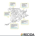 Mapa RECIDA.png 466 × 479; 148 KB
-
 Mapa RMVA e Colar Metropolitano.jpg 2,001 × 2,264; 2.99 MB
-
 Mapa rozrostu terytorialnego Oświęcimia.png 3,840 × 2,160; 602 KB
-
 Mapa TP2024.png 800 × 941; 171 KB
-
 Mapa zemí Evropy s patentovým boxem pro rok 2022.png 910 × 517; 94 KB
-
 Mapa-voseo-latinoamerica-real.png 1,472 × 1,960; 630 KB
-
 Mapa.Igel greziarra.pdf 1,241 × 1,754; 345 KB
-
 MapAltayRH.jpg 336 × 372; 13 KB
-
 Mapapozuelodearagon.gif 275 × 300; 3 KB
-
 MapaTP23-2.png 800 × 941; 126 KB
-
 MapaTP23-3.png 800 × 941; 134 KB
-
 MapaTP23-4.png 800 × 941; 127 KB
-
 MapcartaScreenshot.jpg 2,128 × 1,021; 1,020 KB
-
 MapChart Map 2024.png 6,460 × 4,244; 2.45 MB
-
 MapChart Map poUPiTbT.png 2,510 × 1,696; 488 KB
-
 Mapgoldenhill.jpg 631 × 466; 136 KB
-
 MapHU.jpg 636 × 700; 142 KB
-
 MapoArbaroOrleans eo.gif 2,245 × 1,587; 84 KB
-
 MapofAbik.png 1,280 × 548; 139 KB
-
 MapofHasanlu.jpg 700 × 577; 69 KB
-
 MapofHasanlu2.jpg 446 × 490; 48 KB
-
 Mappa canali agro pontino.png 917 × 574; 472 KB
-
 Mappa Val d'Esino.png 1,010 × 2,532; 689 KB
-
 Mappa-s-maria-in-campis.png 589 × 841; 400 KB
-
.jpg/120px-Maps_of_Locations_(Mark).jpg) Maps of Locations (Mark).jpg 936 × 583; 206 KB
Maps of Locations (Mark).jpg 936 × 583; 206 KB


.png)


_map.png)


.png)


_edit.svg)


_and_other_trading_posts_in_Canada.png)


_elaborado_por_la_Academia_Mariana.jpg)


.jpg)